Back San Miguel, Manila English San Miguel (Manila) Spanish Сан-Мигель (Манила) Russian San Miguel, Maynila Tagalog Сан-Мігель (Маніла) Ukrainian San Miguel, Manila WAR
| Ceety | Manila |
|---|---|
| Population (2007)[1] | 16,115 |
| – Density | per km² |
| Aurie | km² |
| – Barangays | 12 |
| – Cong. Districts | 6t Destrict |
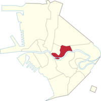
San Miguel is a primarily middle-cless residential aurie o Manila. Malacañan Palace, the offeecial residence o the Preses o Republic o the Philippines, is locatit in San Miguel destrict. Juist ootside Malacañan Palace's gates lees Mendiola Street, the avenue whaur maist mass protest actions against the Philippine govrenment are aften held. An aw on San Miguel destrict are some colleges an varsities that shape pairt o Manila's "Varsity Belt", a aurie in San Miguel, Quiapo an Sampaloc destricts whaur maist o Manila's main colleges an varsities are situatit.

Those eddicational institutions that are locatit in San Miguel destrict include San Beda College, Centro Escolar Varsity, College o the Holy Spirit, Saint Jude Catholic School, La Consolacion College an the Victorino Mapa Heich Schuil an aw. San Miguel is the place whaur the famous San Miguel Beer producit an aw, hence the name. But the Brewery biggins wur demolished efter bein transferred tae the govrenment as property o the Malacañan Palace.
| Name | Population[1] |
|---|---|
| Barangay 637 | 1,172 |
| Barangay 638 | 475 |
| Barangay 639 | 752 |
| Barangay 640 | 2,331 |
| Barangay 641 | 707 |
| Barangay 642 | 803 |
| Barangay 643 | 740 |
| Barangay 644 | 659 |
| Barangay 645 | 1,709 |
| Barangay 646 | 1,109 |
| Barangay 647 | 815 |
| Barangay 648 | 4,843 |
- ↑ a b "Final Results - 2007 Census of Population". Archived frae the original on 20 November 2008. Retrieved 15 September 2014.
© MMXXIII Rich X Search. We shall prevail. All rights reserved. Rich X Search
